Charlestown State Park, IN
Description
Book a Campsite at Charlestown State Park, IN
*** Some sites may be available only from the campground on a first-come-first-served basis.
Description
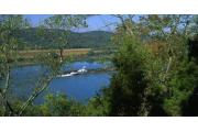
Once a largely undeveloped portion of the Indiana Army Ammunition plant, Charlestown State Park is located in Clark County along the Ohio River in southern Indiana. With over 5100 acres it is Indiana’s 3rd largest state park providing plenty of room for making memories naturally. The park is easily accessible; located 8 miles east of I-65, on State Road 62. With scenic vistas of the Fourteen Mile Creek valley and the Ohio River and elevation changes of over 200 feet, Charlestown has so much to offer its visitors. Its rugged hills, deep ravines, and remnants of a 1920’s era amusement park provide a glimpse into both the natural and cultural history of the area. Over 15 miles of trails ranging from easy to rugged, take you into the forest where you will see wildflowers, fossil outcroppings, and areas of karst topography which include large sinkholes. Bird watchers will enjoy over 70 species of birds, including bluebirds, black vultures and the occasional bald eagle that will make an appearance. The park’s large campground features AA sites (water, sewer, and electricity) as well as Class A sites (electricity only) and modern comfort stations. A large boat ramp provides access for boaters who wish to spend their days on the mighty Ohio.
Electric
Tue Nov 05 2024 - Sun May 04 2025Reservations can be made for today and can be made up to 6 Month(s) in advance.
Full Hookup
Tue Nov 05 2024 - Sun May 04 2025Reservations can be made for today and can be made up to 6 Month(s) in advance.
Shelter
Wed Nov 06 2024 - Tue Nov 04 2025Reservations must be made 2 Day(s) ahead of arrival and can be made up to 12 Month(s) in advance.
- Bird Watching
- Boat Ramp
- Camping, Improved Site
- Comfort Station
- Dump Station
- Easy, Moderate, Difficult Hiking Trails
- Hiking Trail
- INTERPRETIVE TRAIL
- Ice
- Information Center
- Interpretive Services
- Jogging/Running
- Park Office
- Parking
- Pay Telephone
- Photography
- Picnic Area
- Picnic Shelter
- Picnic Tables
- Picnicking
- Playground
- Ranger Station
- Restrooms
- River / Stream
- Sail Boating
- Shelters
- Skiing - Water
- Stargazing
- Telephone
- Toilet, Pit/Vault
- Trails, Difficult Hiking
- Trails, Hiking / Walking, Easy
- Trails, Moderate Hiking
- Viewing Platform/Overlk
- Walking
- Water Access, River / Stream
- Water Drinking
- Water Skiing
- Waterfall
- Waterfall Access
- Wildflower Viewing
- Wildlife Viewing
- Fuel, Boats
- Fuel, Vehicles
- Medical Clinic
- Propane
- Retail, Bait & Tackle
- Retail, Firewood
- Retail, Ice
- Scenic Driving Routes
- Town
- ATM/Cash Machine
- Antiquing
- Church
- Dining
- Emergency Services
- First Aid Supplies
- Grocery Store
- Group / Community Facility
- Hospital
- Kennel
- Laundry
- Maintenance, Boat
- Maintenance, RV/Camper
- Maintenance, Vehicle
- Marina
- Meeting Space
- Newspapers
- Orchard / Produce Farm
- Recycling Station
- Restaurant
- Retail, Drinks
- Retail, Supplies
- Seasonal Festivals
- Sightseeing
- Admin Service, Copying
- Admin Service, Faxing
- Airport
- Art & Museum
- Ball Field
- Botanical Garden
- Camping, Equestrian
- Camping, Primitive
- Car Rentals
- Catering
- Cultural Activities
- Cultural Sites / Exhibits
- Gardens, Botanical Displ
- Golf
- Golfing
- Historic Sites
- Historical Areas/Struct.
- Horse Stalls
- Horseback Riding
- Hunting
- Interpretive Center
- Interpretive Display
- Kiosk
- Lookout Tower
- Mall
- Motel
- Mountain/Trail Bicycling
- Museum
- Musical Performances
- Nature Center
- Outfitter
- PROGRAMS, ARCHEOLOGY
- Park Lake
- Programs, History
- Programs, Instructional
- Programs, Nature
- Programs, Recreational
- Reservoir
- Shopping
- Swimming - Pool
- Trails, Bicycle
- Trails, Equestrian
- Trails, Mountain Bike
- Water Slides
- Winery Tours
Facility Rates*
Nov 04 2024 -
Nov 04 2025
*Displayed rates do not reflect discounts, attribute fees (electrical hookups / water hookups), taxes or incremental charges
**Weekly rates may not be available for all sites
38.43111, -85.645
38°25'52"N, 85°38'42"W
Follow I-65 to I-265E to IN-62 E/E 10th St/Ohio River Scenic Byway in Jeffersonville. Take exit 10 from IN-265 E to access IN-62 E. At the traffic circle, take the exit onto IN-62 E/E 10th St/Ohio River Scenic Byway. Continue to follow IN-62 E/Ohio River Scenic Byway for roughly 8 miles. Destination will be on the right.
Nearby Parks


