BLUE-GREEN ALGAE: Found in lakes year-round. Don't drink the water. Shower after you swim.More information.
ATTENTION : Road Closed (April 2025): Mounds Beach Road, which accesses the beach at Mounds SRA (Brookville Lake) , is closed due to flooding.
Ramp Closed (April 2025): The Treaty Line Ramp at Brookville Lake is closed due to flooding. For other lake access information, visit on.IN.gov/brookvillelake. If you boat, use caution and expect floating debris and submerged vegetation.
MAPPING DIRECTIONS FOR QUAKERTOWN SRA:: Please use 3323 W Dunlapsville Rd, Liberty, IN 47353 when using mapping software to find the Quakertown Campground at Brookville Lake.
BLUE-GREEN ALGAE:: Found in lakes year-round. Don't drink the water. Shower after you swim.More information.
Brookville Lake, IN
Description
Find a Campsite
Overview
Description
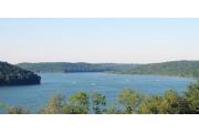
The Brookville / Whitewater Complex has over 13,500 combined acres of land. In addition to the land - each property has a lake-Brookville Lake is approx 5260 acres and Whitewater Lake is approx 200 acres. There are many recreational opportunities available on the combined properties including camping, fishing, hunting, boating, hiking and swimming. Near to the park are Metamora Historic Site, 10 miles, and Kings Island Amusement Park, 65 miles.Services and Amenities
Services & Amenities:
Within Park
- Airport
- Amphitheater
- Archery
- Bath House
- Bicycling
- Bird Watching
- Boat Launch Ramp
- Boating
- Boating, Canoeing
- Boating, Jon(Paddle)
- Boating, Kayaking
- Boating, Pedal
- Boating, Power
- Cabins
- Campground Host
- Camping, Equestrian
- Camping, Improved Site
- Camping, Primitive
- Canoe Rental
- Canoeing
- Comfort Station
- Convenience Store
- Dining
- Dock, Boat
- Dock, Fishing
- Dump Station
- Dump Station, Camper
- Dump Station, Marina
- Fire Rings
- Fish Cleaning Station
- Fishing
- Fishing, Park Lake
- Fishing, Pier
- Fishing, Reservoir
- Fishing, River / Stream
- Fuel, Boats
- Golfing
- Grills
- Hiking
- Hiking - Difficult
- Hiking - Moderate
- Hiking Trail
- Horse Rentals
- Horseback Riding
- Hunting
- Jet Skiing
- Jogging/Running
- Lodging, Cabins
- Marina
- Nature Study
- Office / Ranger Station
- Paragliding
- Parasailing
- Park Lake
- Parking
- Pay Telephone
- Photography
- Picnic Area
- Picnic Shelter
- Picnic Tables
- Picnicking
- Pier, Fishing
- Playground
- Propane
- Ranger Station
- Recreation Programs
- Rentals, Boats, Canoe
- Rentals, Boats, Jon(Paddle)
- Rentals, Boats, Kayaks
- Rentals, Boats, Motorized
- Rentals, Boats, Pedal
- Reservoir
- Restaurant
- Restrooms
- Retail, Bait & Tackle
- Retail, Firewood
- Retail, Ice
- Retail, Seasonal Concessions
- Retail, Snacks
- Retail, Store/Gift Shop
- Retail, Supplies
- Sail Boarding
- Sail Boating
- Scuba Diving
- Sightseeing
- Skiing - Water
- Snorkling
- Stargazing
- Sunbathing
- Swimming - Park Lake
- Swimming - Reservoir
- Toilet, Pit/Vault
- Trails, Bicycle
- Trails, Difficult Hiking
- Trails, Equestrian
- Trails, Hiking / Walking, Easy
- Trails, Moderate Hiking
- Trails, Mountain Bike
- Viewing Platform/Overlk
- Volleyball
- Volleyball Net
- Walking
- Water Access, Park Lake
- Water Access, Reservoir
- Water Access, River / Stream
- Water Drinking
- Water Skiing
- Wildflower Viewing
- Wildlife Viewing
- Windsurfing/Sailboarding
Within 10 Miles
- ATM/Cash Machine
- Ball Field
- Catering
- Church
- Emergency Services
- First Aid Supplies
- Grocery Store
- Information / Contact Station
- Kennel
- Laundry
- Maintenance, Boat
- Maintenance, RV/Camper
- Maintenance, Vehicle
- Medical Clinic
- Newspapers
- Retail, Drinks
- Tennis
- Tennis Court
- Town
Greater Than 10 Miles
- Admin Service, Copying
- Antiquing
- Aquarium Display
- Arboretum
- Art & Museum
- Botanical Garden
- Car Rentals
- Cultural Sites / Exhibits
- Group / Community Facility
- Historic Sites
- Historical Areas/Struct.
- Hospital
- Motel
- Museum
- Musical Performances
- Putt-Putt
- Putt-Putt Course
- Seasonal Festivals
- Shopping
- Theme Park
Getting There
GPS Info. (Latitude, Longitude):
39.50378, -84.94833
39°30'14"N, 84°56'54"W
Brookville / Whitewater Complex is located on Highway 101 between Liberty and Brookville. From Indianapolis and Dayton take Interstate 70 to Exit 151, Hyw 27 S. Take Hyw 27 South to Liberty and Hyw 101 South. From Cincinnatti take Interstate 74 to Exit 169, Hyw 52 W. Take Hyw 52 W to Brookville and then Hyw 101 N.
Nearby Parks

[7.56 miles*]

[33.77 miles*]

[40.4 miles*]


